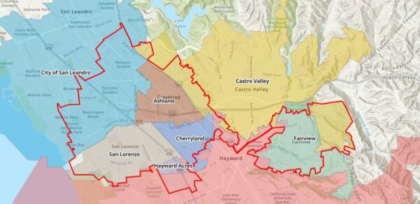
Districting, or redistricting is the process of dividing up a jurisdiction, like a county, city, or school district, into areas that elect representatives. Where and how these areas are drawn designates who can be elected, how communities are recognized, and more.
Districts should reflect their communities. This is where you come in. You Map It makes it easy for everyday people to grab a digital brush and help paint the future.
Select a redistricting campaign below to start drawing your map and make your voice heard.
Pick a redistricting campaign from the active list above. You'll see a map of the area with census blocks ready to assign.
Select a district color and click blocks to build your map. The tool tracks population balance so you can keep districts even.
Save your plan and share the link. Your map becomes part of the public input that shapes the final boundaries.
Whether you're drawing district lines or mapping your community, your input makes a real difference.
Every 10 years after new Census data is released, district lines get redrawn. In most places, elected officials draw these lines — including the ones for their own seats. Now you can try your hand at redistricting. It's easy to make plans of your own and share them so your ideas are part of the conversation.
Communities of Interest are groups or neighborhoods with significant shared interests that deserve consideration by representatives. Many states require that these communities be kept whole. Put your community on the map by marking the places that matter and making your shared interests visible to decision-makers.
You Map It is a community mapping platform operated by Turner Communications Group. We partner with local jurisdictions to run redistricting campaigns that put the tools of democracy directly in the hands of residents.
Our platform is built on open-source redistricting technology and uses official Census data to ensure accuracy and transparency. No login or download required — it works on any device with a web browser.
Entirely in-browser, no login required. Works on phones, tablets, and computers. Every plan gets its own shareable link.
All data comes from the U.S. Census and official state databases. We don't collect personal information about users.
Different places have different priorities. We customize each campaign to highlight the specific concerns and rules that matter locally.
Community maps are compiled and presented to decision-makers. Your input goes directly into the official redistricting process.